
BELLEVIEW, FL (352today.com) – The City of Belleview is proud to announce the launch of a new interactive map on the city’s official website, providing residents, businesses, developers, and community stakeholders with a comprehensive and accessible way to view large-scale residential and commercial development projects currently planned or underway throughout the city.
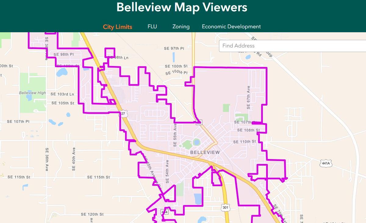
Developed and maintained by the city’s Development Services Department, the Interactive Development Map serves as a centralized, user-friendly resource designed to improve transparency and keep the public informed about Belleview’s ongoing growth and development. The tool allows users to explore active and proposed projects across the city through an interactive interface that includes project graphics, development updates, and detailed information about each initiative.
The new map supports the city’s broader commitment to open government, proactive communication, and community engagement by making important information readily available online. Residents can conveniently access the Interactive Development Map by visiting belleviewfl.org and selecting the “Interactive Maps” option.
City Administrator Mariah Moody emphasized the city’s ongoing commitment to using technology to strengthen communication and educate the community.
“The City of Belleview is dedicated to leveraging technology to improve how we communicate with our residents,” said Moody. “The Interactive Development Map reflects our commitment to transparency and innovation. It provides accessible, real-time information about our community. This tool helps residents better understand the changes taking place around them and supports informed civic engagement.”
Development Services Director Shawna Chancey highlighted the value of the tool in fostering transparency and helping residents better understand how development contributes to the city’s future.
“The Interactive Development Map provides our community with a clear accessible way to see how Belleview is growing and evolving,” said Chancey. “By sharing timely updates, visuals, and detailed project information, we strengthen transparency and give residents access to information that impacts our city.”
The Interactive Development Map offers users the ability to view key project details such as development status, location, and visual representations of proposed or ongoing work. By presenting this information in an easy-to-navigate format, the city aims to enhance understanding of planning efforts and support informed community participation in local development discussions.
Planning and Zoning Specialist Kelley O’Neill noted that the tool will improve accessibility to planning information and streamline how residents and stakeholders interact with development data.
“This map makes it easier for the public to view projects and understand what is happening,” said O’Neill. “It serves as a source of information, encourages community engagement in the planning process and helps residents stay connected.”
The Interactive Development Map will be updated regularly by the Development Services Department to reflect new projects, status changes, and additional information as development activity progresses. The city encourages residents, business owners, and community partners to explore the platform and use it as a reliable resource for staying informed about Belleview’s growth and development initiatives.
For more information or to view the Interactive Development Map, visit belleviewfl.org and select “Interactive Maps.”