
OCALA, FL (352today.com) – The City of Ocala‘s Engineering Department held its second community road and safety planning meeting at the Institute of Human and Machine Cognition Wednesday, Nov. 5, 2025.
The main impetus to the project is to try to do more to create safe streets and roads within the city and it includes all facilities, including pedestrian traffic areas like sidewalks, said Sean Lanier, City of Ocala engineer and director of water resources and engineering.
Driving and traveling depend on voluntary compliance, so safety starts with each individual driver, which is the primary variable in the equation. Control mechanisms can be put in place, like traffic lights and pedestrian signals, but pedestrians won’t be protected if someone runs a red light, said Lanier. The city is working in concert with the State of Florida and the Ocala/Marion County Transportation and Planning Organization.
“We share the roads with each other, and that’s what makes civilization, so that’s the first thing,” said Lanier. “We want everybody’s input. We don’t travel the roads all the time. We’re not out there at night or early morning. One thing that’s been brought up tonight is lighted streets. There are some areas that don’t have streetlights and maybe not enough streetlights, we’d like to know about it. That’s a big thing when you’re trying to walk as a pedestrian, but even if you’re a driver and a pedestrian is walking on the street. We want to know about that, so the city can address that as best as we can. We’re working within constraints just like everybody else. We have one budget. That money that we have not only goes for new stuff and fixing things, but it’s the maintenance side too for maintaining everything that we already have.”
The city applies for grants and diligently does as much as they can with the extra money that’s available to them, said Lanier. The city also conducts a legislative appropriation wherein they request funds for projects from the legislature. The City of Ocala received a fiscal year 2023 Safe Streets and Roads for All SS4A Grant and is using it to make local roads safer.
The first meeting was to gather feedback from the public regarding where the safety concerns are, and to present some of the information related to crash data, said Christy Lafoye, Ardurra Group consultant.
“At this meeting, we’re still looking for feedback, so that’s not ending, but we’re so much further in the planning studies that we’ve had time to analyze some of the data, come up with some focus areas for the city, and we have 12 segments that have been identified as the City of Ocala’s local high injury network,” said Lafoye. “Those are high concentrations of fatal and severe injury crashes, and then we’ve also come up with segments that we feel are important for the city to prioritize for speed management.”
Speed management can be done in a number of ways, said Lafoye. There are engineering countermeasures, non-engineering countermeasures, education, and enforcement, so it can be approached from a number of angles.
“There are a lot of things that can be done for speed management that make them self-enforcing, so that people will drive the posted speed,” said Lafoye. “Some people will adhere to a posted speed limit, no matter what, a small percentage of the population will do that, most people will drive what they feel most comfortable driving with, what they feel that the roadway allows.”
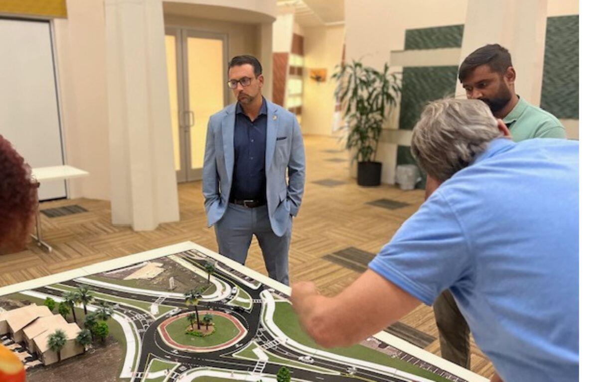
By taking a closer look at the priority segments, discussion and decisions can be made if speed bumps, roundabouts, raised crosswalks, speed feedback signs for awareness, lane narrowing and street trees can and should be installed.
There are two different studies. One, the local road safety plan, was unveiled at Wednesday’s meeting, and focuses on the segments in the city where there’s high severity crashes and what can be done. There will be a speed management plan and traffic calming policy, targeting safer driving speeds in neighborhoods near schools, centered around these segments as identified, said Lafoye.
Comments will be accepted through Nov. 19. The survey is available on the city’s website, the online interactive comment map is still live, and that will remain; there are also QR codes on the city’s website. If you’d like to access the survey, enter safe streets or SS4A in the search bar, it will take you to the project page and there are QR codes for the survey and the interactive comment maps.