
OCALA, FL (352today.com) – The band The Lovin Spoonful didn’t sing the lyrics, “Hot town, summer in the city. Back of my neck getting dirty and gritty” because the summer weather is crisp and cool. (You’re welcome for that earworm.)
The National Weather Service says heat indices will be 103-107 degrees on Monday and Tuesday.
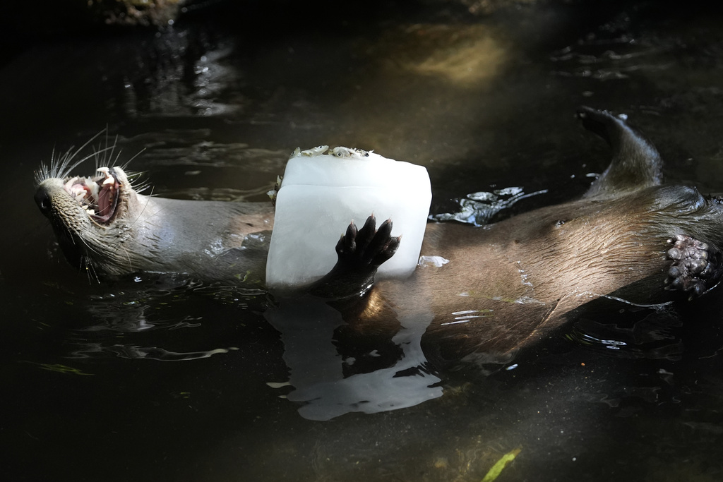
The heat isn’t just hard on humans. It takes a toll on animals as well.
The staff at Florida’s Palm Beach Zoo & Conservation Society in West Palm Beach use a variety of techniques to keep their animals cool during the hot summer months ranging from ice blocks to spraying the animals down and, of course, access to ample supplies of clean water.


As we continue to endure scorching temps, we’re taking a cue from the zookeepers and sharing some tips for how you can stay hydrated during the sweltering days ahead.
|BEAT THE HEAT: 6 tips for staying hydrated this summer
Strong thunderstorms in the forecast
It’s easy to ignore weather information during this time of the year because we all realize the heat and thunderstorms are just part of living in Florida in the summer.
But it’s important to know the difference between your average rainstorm and ones that have the potential to be damaging.
|COOL CONTEST: Enter our Christmas in July contest and win $2,000 in “ice”
The National Weather Service says the storms Monday afternoon have the potential to be strong, bringing lightning, gusty winds and heavy downpours between 3 and 9 p.m.

Ocala Forecast
Here’s your day-by-day outlook from the National Weather Service.
Today: A 30% chance of showers and thunderstorms, mainly after 2 p.m. Patchy fog before 8 a.m. Otherwise, mostly sunny, with a high near 94. Heat index values as high as 107. Calm wind becoming southeast 5 to 7 mph in the morning.
Tonight: A 50% chance of showers and thunderstorms, mainly before 10 p.m. Patchy fog after 4 a.m. Otherwise, mostly cloudy, with a low around 73. East wind around 6 mph becoming calm in the evening. New precipitation amounts between a tenth and quarter of an inch, except higher amounts possible in thunderstorms.
Tuesday: Showers and thunderstorms, mainly after 2 p.m. Patchy fog before 8 a.m. High near 93. Heat index values as high as 103. Calm wind becoming south around 5 mph in the afternoon. Chance of precipitation is 90%. New rainfall amounts between a tenth and quarter of an inch, except higher amounts possible in thunderstorms.
Tuesday Night: Showers and thunderstorms, mainly before 8 p.m. Low around 75. Calm wind. Chance of precipitation is 80%.
Wednesday: Showers and thunderstorms, mainly after 2 p.m. High near 93. Calm wind becoming southeast around 6 mph in the morning. Chance of precipitation is 90%.
Wednesday Night: Showers and thunderstorms likely, mainly before 8 p.m. Mostly cloudy, with a low around 75. Chance of precipitation is 60%.
Thursday: Showers and thunderstorms, mainly after 2 p.m. High near 93. Chance of precipitation is 80%.
Thursday Night: Showers and thunderstorms, mainly before 8 p.m. Low around 74. Chance of precipitation is 80%.
Friday: Showers and thunderstorms, mainly after 2 p.m. High near 92. Chance of precipitation is 80%.
Friday Night: Showers and thunderstorms before 8 p.m. Low around 74. Chance of precipitation is 80%.
Get your 352 weather info here anytime you need it or download our free app. Be sure to enable the weather alert to receive notifications to your cellphone.