



MIAMI, FL (352today.com) – It’s been a very quiet hurricane season so far, but the Atlantic Ocean is starting to show signs of activity.
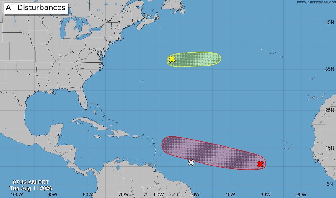
The National Hurricane Center is currently eyeballing three weather systems to the east, and while one is expected to develop into a tropical cyclone at some point over the next seven days, none are expected to threaten either of Florida’s coastlines.
The system most likely to intensify is located about 500 miles southwest of the Cabo Verde Islands, which themselves are located approximately 350 miles off the west coast of Africa. This system is showing limited shower and thunderstorm activity in association with a low pressure system.
“Environmental conditions are forecast to become more conducive for development over the next couple of days, and a tropical depression will likely form during the latter half of this week while the system moves westward to west-northwestward across the central tropical Atlantic,” said a National Hurricane Center update, which put the odds of development at 70 percent on Tuesday morning.
That system may merge with another, very weak and disorganized system east of the Windward Isles that is not expected to develop on its own.
The third system, in the central subtropical Atlantic far to the east of Chesapeake Bay and “several hundred miles northeast of Bermuda,” is likewise unlikely to develop, with National Hurricane Center odds at 10 percent.